|
When you export survey data, you write data from the current survey to a file or send it directly to one of the supported serial devices like a data collector.
To Export Survey Data
•From the TPC Desktop™ menu choose File | Export.
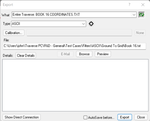
•Use the What List to select the survey data to export.
•Select a file Type from the pulldown list and modify the settings as needed.
•Accept the default export file name or modify its file name or path.
•Choose Export.
Using the What List
The What List is key to choose what data to export. You can select specific points from the Points Manager, specific traverses from the Traverses Manager and so on.
Export Settings
TPC supports a number of different import formats including ASCII coordinates, SDR, TDS, Leica (Wild), DC1Z and DXF. Each format has its own export settings that allow you to control how the data is exported.
If you don't get exactly what you want for the exported data, change the settings and export again, even overwriting the original export file if desired.

Preview File After Export
Most export settings will have a option labeled 'Preview after export'. When this is tagged TPC will automatically preview the file you exported.
Exporting Excel CSV Files
You can export data from many of the views to a Microsoft Excel CSV file. These files can be opened directly by Microsoft Excel simply by double clicking them in Windows Explorer.
Calibrating on Export
Some export types, like ASCII, SDR and TDS allow you to calibrate or reverse calibrate when you export. If you have used a calibration to get imported data onto your survey grid, you can reverse calibrate on export to send data back to a client or project in their coordinate system. See Calibrating Coordinates on Export.
Related Topics
Export command
What List
Export Settings
Calibrating Coordinates on Export
|

