|
This dialogs presents information about the calibration and lets you edit it.
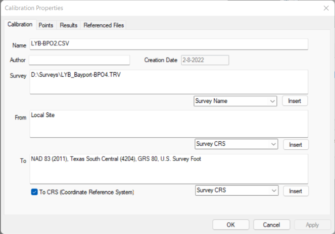
Name
Enter a calibration name that is succinct but descriptive. TPC displays this name
•at the top of all calibration reports
•object tool tips
Creation Date
The date the calibration was created. Use this to help identify where and when a calibration comes from.
Author
The person who creates the calibration. By default, TPC gets this name from the Surveyor dialog.
Survey
Enter information about the survey or select items from the pull down list and Insert them into this field.
The survey information helps you identify the origin of a calibration if you share the calibration with other surveys.
From
Enter information about the Uncalibrated coordinate system. You can select an item from the pulldown list and choose Insert.
To
Enter information about the calibrated coordinate system (the coordinates system Uncalibrated points are in after a calibration). You can select an item from the pull down list and choose Insert.
To CRS
Turn this on to tell TPC that you have calibrated to the survey's CRS (Coordinate Reverence System). These coordinates are ready for geodetic computations like the corresponding latitude & longitude, theta angle and grid factor. See Calibrations and Coordinate Reference Systems.
OK
If you make any changes to the calibration, TPC will prompt you to save the calibration. You can use it's current filename which updates (overwrites) the calibration file or save it as a new calibration.
Related Topics
Calibrating Data
Editions
Premium, Professional
|

